
Street cars preceded local bus lines
The Ithaca Journal, Centennial edition, Friday, 08-April-1988By D G Rossiter
It's more than 100 years ago - on Dec. 27, 1887 - that the original line of the Ithaca Street Railway opened, running along State Street from the Lehigh Valley station on West Buffalo Street to the Ithaca Hotel at State and Aurora Streets. At the time, this was one of only three operating electric railways in New York state. Two small streetcars shuttled continuously between the two terminals, providing a 10-minute headway.
The system was soon extended in two directions: the entire length of N Tioga Street and then west on Lincoln Street to the old steamboat landing in 1892, and up East Hill to South Avenue on the Cornell campus and to the East Ithaca railway station in 1893. State and Eddy Streets were selected as the easiest route up the hill. The links between campus, Collegetown, the downtown stores and rooming houses, and the railroad depots of the West End formed a traffic pattern that continues to this day.
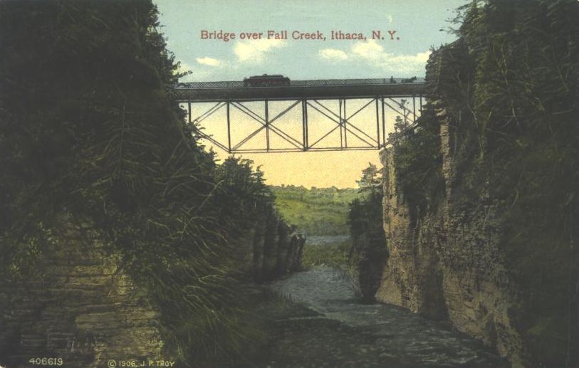
In 1894 the Tioga Street line was extended to Renwick (now Stewart) Park, which was owned by the same interests as the street railway, and the Lincoln Street line was abandoned. In 1895 the campus line was extended to the University (now Uris) Library. In 1900 this line was extended across the newly-built Triphammer Bridge over Fall Creek into Cornell Heights, down Thurston Avenue and around The Knoll, back across Fall Creek and along Stewart Avenue to State Street, forming a loop around which cars traveled in both directions.
Not coincidentally, Edward G. Wyckoff, who owned the entire Cornell Heights tract, had obtained control of the street railway just four years earlier. The Cornell Heights extension was so successful that Wyckoff and a few other prominent Ithacans decided to try the same thing on a larger scale. In 1901 they formed a land company to buy and subdivide most of Cayuga Heights south of Upland Road, and also built an extension of the street railway into it. This line opened in the summer of 1906. It left the Cornell Heights loop at Wyckoff and Thurston Avenues, and followed Wyckoff Avenue and Highland Road almost to Upland Road. It then descended the hill in three long loops to reach Renwick Park, there joining the Tioga Street line.
Unfortunately for Wyckoff, Cayuga Heights did not develop fast enough to support most of the line, and after two years the line was cut back to Kline Road, just into Cayuga Heights. By 1919 there had been sufficient development along Highland Road to extended the line, by then humorously referred to as the "Great Northern", to the Five Corners (Upland Road).
In 1914 the street railway was re-organized as the Ithaca Traction Company, and was extensively re-built. New streetcars were ordered, but the economics of the day were against street railways, which had to maintain their own right-of-way and power plant. In 1924 the ITC became bankrupt, and re-organized as the Ithaca Railway in 1929.
The "Great Northern" and the line to East Ithaca depot [from College and Oak avenues] were discontinued in 1930. In 1934 a bus operator, Sweet & Oster, bought the franchise and replaced the streetcars with motor buses in the summer of 1935. The buses followed as far as possible the exact routes of the streetcars [,using roads in place of private right-of-way when necessary, for example using Stewart and Thurston Avenues instead of the streetcar right-of-way around The Knoll], and this pattern was maintained until August 1961, when operators discontinued bus service due to excessive losses.
On August 10, 1961, Common Council approved the formation of the Community Transit System to provide local transit, and two days later service began. In the summer of 1962, the system obtained its first new buses, and the routes were adjusted to the current "figure-eight" pattern.
Subsequently re-named Ithaca Transit in the mid-1970s, this system is one of the success stories of small city transit. Routes have been added to all parts of the City as well as to Stewart Park, Buttermilk Falls, Ithaca College, East Hill Plaza and the Tompkins Community Hospital. Ridership has increased from about 150,000 in 1961 to 849,000 in 1987. The employees of Ithaca Transit are known for their friendliness to longtime residents and newcomers alike. And the fare is a very reasonable 35 cents.
The rattling Birney streetcars have been replaced by comfortable Orion buses, but the alert observer can still find traces of the Ithaca Street Railway. Most notable is the pedestrian footbridge across Cascadilla Gorge in Collegetown. The line around [the Thurston Avenue side of] The Knoll today serves as a driveway as it leaves Thurston Avenue at Barton Place; [this section was a two-tracked passing loop]. The graded roadbed and concrete culverts of the lower loops of the Cayuga Heights line can be seen just east of Renwick Road near the end of N Sunset [and Devon] Road.
Note: This version has been slightly modified from the published version: (1) spelling, punctuation, and paragraph division have been adjusted to my current taste, (2) some information has been expanded (always in [square brackets]).
Here is a map showing the locations mentioned in the tour guide.
Addendum 1997: Relics of the Ithaca Street Railway
Addendum 2000: Changes in relics
Addendum 2000: Public Transit in Ithaca today
Official site of Tompkins Consolidated Area Transit (TCAT) , including maps and schedules.
Most traces of the Ithaca Street Railway route structure are now gone, replaced by much-improved service to the suburbs and outlying areas.
Addendum 2004: Open questions
I would appreciate any help you can give on the following uncertainties I have about the exact location of the ISR; I was born too late to see it in action, and did not start looking for relics until about 1962, when much evidence was already removed.
Historical photos
These are from three years after final abandonent. Although they are summer images, some parts of the system are clearly visible.
Photo Tour 2004
Author: D G Rossiter